Falling Down the Thames Blog 12, 3rd June 2014
Where To Stop
Source-to-sea adventures can be a bit tricky, even in terms of cartography. If you want to know where to end your journey, you have to know where the river ends.
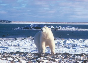
Sometimes the answer is simple. The Churchill River is the ninth longest river in Canada. It stretches 1600 kilometres across the provinces of Alberta, Saskatchewan and Manitoba. But as it discharges into Hudson Bay, you could pretty easily pick a line between two points of land and say: “There. Between Cape Merry and the Prince of Wales Fort. That is where the river becomes the sea.”
But sometimes the answer is a lot more complex. The Río de la Plata in South America receives water from the Río Uruguay and the Río Paraná. After that, about the only things that people can agree on are that the Río de la Plata is tidal, and that it connects to the Atlantic Ocean. Some authorities feel that it isn’t a river at all, but rather a sea of the Atlantic. If it is a river, then it officially stops being a river along a line between Punta del Este in Uruguay and Cabo San Antonio in Argentina. These points are 220 kilometres apart, making the Río de la Plata the widest river in the world, almost as wide as it is long.
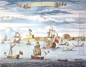
The River Thames is toward the complex end of the spectrum. After passing through or past eight English counties, it just keeps getting wider and wider until eventually you have to admit that you are paddling in the North Sea. But where does the river and its estuary end? Where is the mouth of the Thames, and where will Krista and I stop paddling? In the 19th century, cartographers drew a line between Margate in Kent and Harwich in Essex, roughly twenty kilometres apart. More modern sources hum and haw about Southend-on-Sea on the north shore, and Sheerness on the south shore. Surely we wouldn’t end our adventure half-way between those communities, four kilometres from shore.
Much of the history of my family is associated with the coastline of Kent. I have suggested to Krista that we continue along the Thames Estuary’s south shore, past Sheerness, past Whitstable and Herne Bay, past the towers at Reculver, around the corner past Margate, Broadstairs and Ramsgate, stopping just shy of Sandwich at a site known as Richborough.
Admittedly, at 2.8 km from the coast Richborough doesn’t fall within our two kilometre rule. But if we don’t want to carry the kayak all the way to Richborough, we will probably be able to paddle to within a couple of hundred metres of the site by travelling up the River Stour.
And in a later blog I will tell you exactly what is so special about Richborough.
- Glen
Photo credits: Sheerness - www.1st-art-gallery.com; polar bear near Churchill, Manitoba – www.yagotta.ca


